Towering heights of the Kunlun, a huge mountain range bordering the Tibetan Plateau from the North, have down to present days remained a “blind spot” on the maps, where only very few paths have been made by very few travellers. One of the first of those, Nikolai Przhevalsky, gave Russian names to ridges and peaks in Kunlun. Major discoveries are still possible and are still made in this region even today, although it might seem that the “eyes” of observation satellites have penetrated everywhere. In 2009 the expedition lead by Otto Chkhetiani discovered a new summit, Eastern Chong-Muztag (6976 m), in the upper course of the Keriya river. A highest peak in the range that wasn’t mapped nor catched on satellite images.
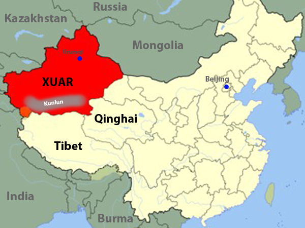
 Map of China. The red area highlights Xinjiang Uyghur Autonomous Region (XUAR) of China, where the expedition took place. XUAR borders Tibet to the South, Quinghai and Gansu provinces of China to the East. Capital of XUAR is Urumqi. Along the southern border of Xinjiang stretch from the West to the East the ranges of Kunlun mountains.
From the glaciers of Kunlun, copious rivers break through the mountains on their way to Taklamakan desert, where they vanish in the immense sands. We know of only two attempts to descend these rivers. In 1990 an American team succeeded in conquering the middle and low course of the Yarkand River, the westernmost river in Kunlun. In 2007 a Russian expedition team lead by Sergey Chernik made the first descent of the upper course of the Yurunkash river, but ended by death of four members of the team on one of the most difficult stretches of the river.
Read more »
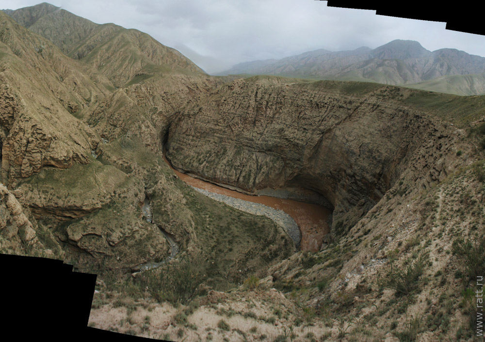
 Portrait of Cherchen (the nice brownish band down there is exactly it). To grasp the scale – the river discharge is 60 cubic meters.

 Map of China. The red area highlights Xinjiang Uyghur Autonomous Region (XUAR) of China, where the expedition took place. XUAR borders Tibet to the South, Quinghai and Gansu provinces of China to the East. Capital of XUAR is Urumqi. Along the southern border of Xinjiang stretch from the West to the East the ranges of Kunlun mountains.


